Life-threatening rip currents are likely along Jacksonville Beach and neighboring Beaches communities through late Friday night, according to the National Weather Service in Jacksonville.
The agency's 11 a.m. Thursday, Oct. 22, surf forecast covers the Northeast Florida coast, including Duval County.
Surf expected to build
The forecast calls for 4- to 5-foot surf Thursday and Friday. Water temperatures Thursday range from 72 to 77 degrees.
Surf is forecast to increase to 7 to 9 feet Saturday and 10 to 12 feet Sunday, with northeast winds around 25 mph. Showers and a slight chance of thunderstorms are forecast Saturday; showers are likely Sunday.
Weekend projections can change. The current high rip-current risk period runs through late Friday night.
How to stay safe
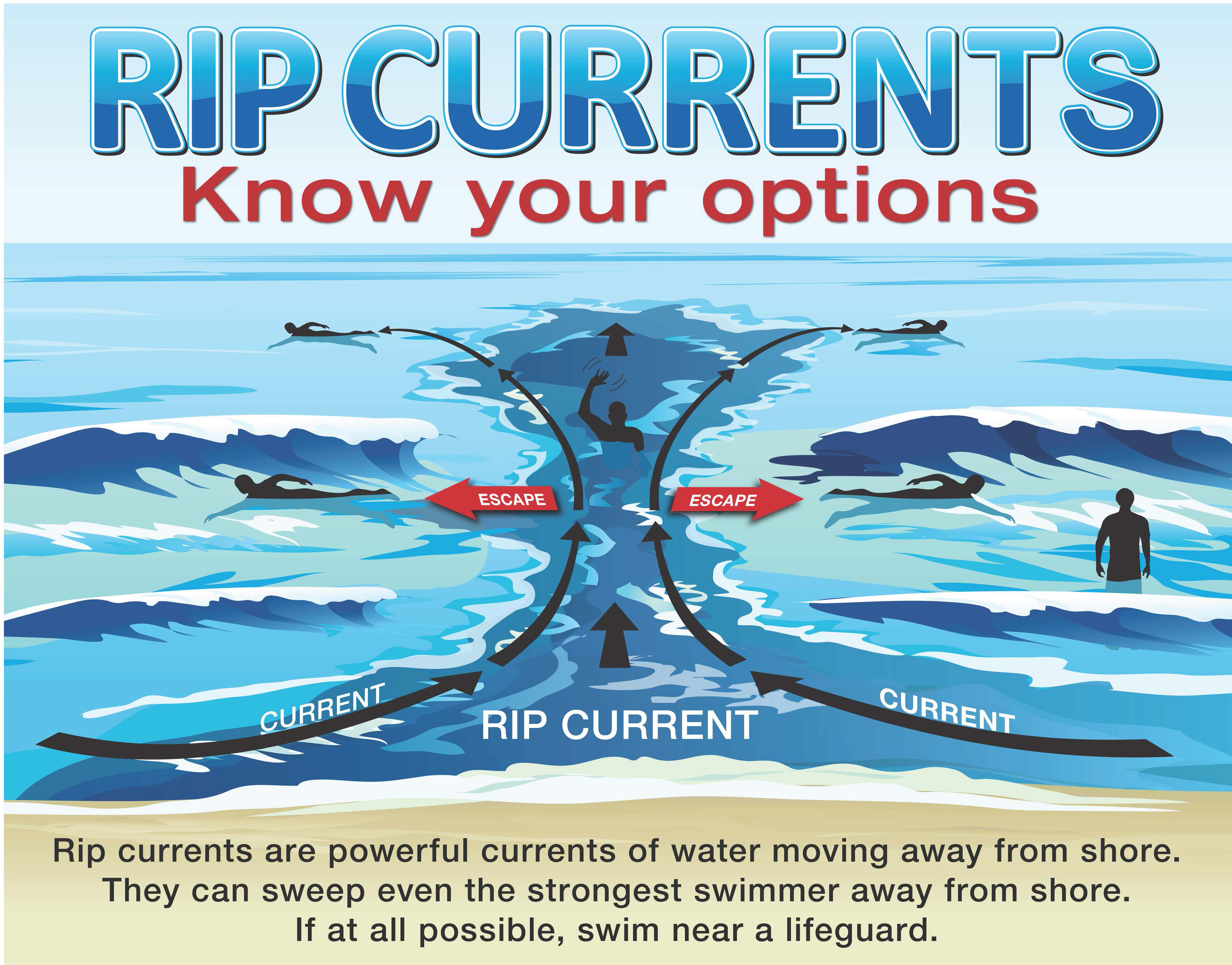
Rip currents are fast-moving channels of water that generally flow away from shore. They can form in calm or rough conditions, often near breaks in sandbars, jetties and piers, according to Jacksonville's beach safety guide.
Warning signs include gaps in breaking waves, unusual choppiness, discolored water and foam or debris moving offshore.
If caught in a rip current, do not fight it. The National Weather Service safety graphic advises swimming sideways out of the current, then toward shore. If unable to escape, float or tread water and signal for help.
Follow beach warning flags and lifeguard instructions, swim near a lifeguard and never swim alone. If someone is in distress and no lifeguard is on duty, call 911 rather than entering the water to attempt a rescue.